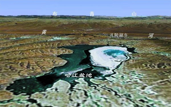
The Hajiang Salt Lake, is located about 3 km southwest of Zhalinghu Township in the upstream of the Yellow River in Maduo County, Guoluo Tibetan Autonomous Prefecture, Qinghai Province. The geographic coordinates are 97.8811? ~97.9181? E, 35.0238? ~35.0678? N, the lake elevation is 4253 m, and the area is about 10 km2.
The formation of the Hajiang Salt Lake is the result of the combined development of the Yellow River traceability and climate. About 7-8ka BP, the Yellow River expanded Eling Lake and Zhaling Lake into a new source area of the Yellow River due to traceability erosion. In the process, the Yellow River captured the river supply from the south of Buqing Mountain on the north side, causing the Hajiang Salt Lake to lose its original supply source and eventually become a closed small lake. The lake water rich in soluble salts is continuously evaporated and concentrated by the strong wind and sun in the plateau, and eventually forms a salt lake.
The Hajiang Salt Lake is known throughout the Kangzang region for its long history of salt mining. It is considered to be the starting point for the migration and expansion of the ancient Qiang people from the grassland in the northeast of the Tibetan Plateau to the Chengdu Plain, and benefited from the development and transportation of salt. Use an important research position in the study of the origin of ancient Shu civilization. The ancient Qiang people who lived in the northeast of the Qinghai-Tibet Plateau migrated eastward and expanded. They first entered the western Sichuan Plateau and its marginal valleys. One of them passed through the upper reaches of the Minjiang River and finally reached the Chengdu Plain. It evolved into the ancient Shu ethnic group and believed that The starting point for them to enter Sichuan is the Haqiang Salt Sea (that is, the Hajiang Salt Lake), and salt is one of the driving forces for its migration and development.
.

Location of Hajiang Salt Lake

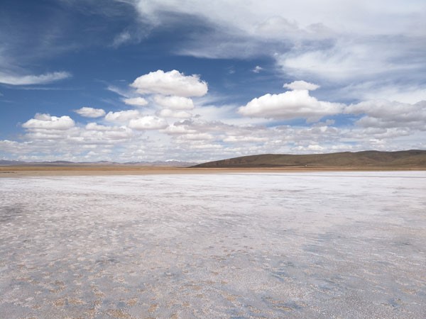
The appearance of the Hajiang Salt Lake
...
